Difference between revisions of "Foreman, Solomon W."
From Santa Cruz County history wiki
| Line 2: | Line 2: | ||
[[File:S.W. Foreman photo.jpg|left|300px]] | [[File:S.W. Foreman photo.jpg|left|300px]] | ||
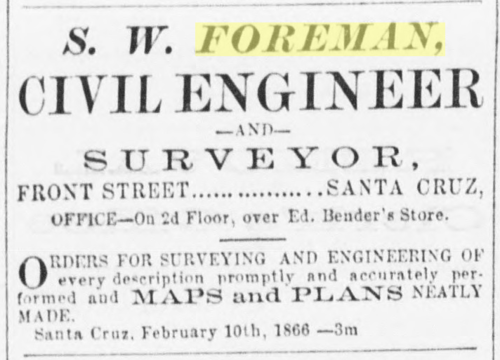
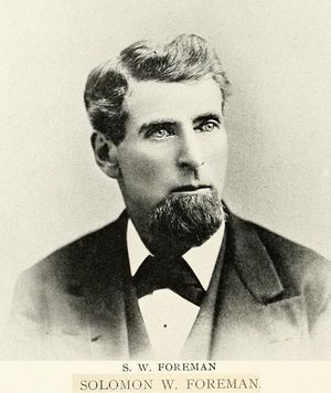
'''Solomon W. Foreman''' ([https://www.findagrave.com/memorial/26507533/solomon-w-foreman 1821-1888]) was an early civil engineer and land surveyor in Santa Cruz County, and was one of the two commissioned to create the [[1866 Santa Cruz map]], along with County Surveyor [[Wright, Thomas W.|Thomas W. Wright]]. He is interred in San Luis Obispo. | '''Solomon W. Foreman''' ([https://www.findagrave.com/memorial/26507533/solomon-w-foreman 1821-1888]) was an early civil engineer and land surveyor in Santa Cruz County, and was one of the two commissioned to create the [[1866 Santa Cruz map]], along with County Surveyor [[Wright, Thomas W.|Thomas W. Wright]]. He is interred in San Luis Obispo. | ||
| + | *[https://cdnc.ucr.edu/?a=d&d=SCWS18660623.1.2&srpos=1&e=-------en--20-SCWS-1--txt-txIN-%22Map+of+the+Town%22-------1 "The Official Survey of Santa Cruz"], ''Santa Cruz Sentinel'', June 23, 1866, 2:4. | ||
[[Category:Persons]] | [[Category:Persons]] | ||
[[Category:Group-Architecture/Engineering/Construction]] | [[Category:Group-Architecture/Engineering/Construction]] | ||
[[Category:1866 town property owners]] | [[Category:1866 town property owners]] | ||
Revision as of 04:58, 27 October 2021
Solomon W. Foreman (1821-1888) was an early civil engineer and land surveyor in Santa Cruz County, and was one of the two commissioned to create the 1866 Santa Cruz map, along with County Surveyor Thomas W. Wright. He is interred in San Luis Obispo.
- "The Official Survey of Santa Cruz", Santa Cruz Sentinel, June 23, 1866, 2:4.

