History Pages: 50 - Downtown expanded south in the 1880s
For a table of contents, see History pages.
The years from the mid 1870s to late 1880s saw continued growth and transformation in Santa Cruz – especially south of Cooper Street. The 1874 covered bridge provided a year-round downtown connection for the Watsonville road (part of the old mission road route). Tourism was bringing more visitors to our town than ever, now that train and steamship travel had reduced the time and effort involved. Local industries continued to prosper: lime, lumber, bituminous rock, blasting powder and others.
Following the new bridge opening, Front Street was extended from Cooper to Bridge Street (today's Soquel Avenue). At that new road junction, the Fair Pavilion was built in 1883. The pavilion housed autumn harvest fairs and spring rose fairs, among various other events. On New Year’s Eve 1884, the pavilion was illuminated by the first electric lights in Santa Cruz (but not the first in the County - see note 1), powered by a steam generator brought in from San Francisco.(note 2)
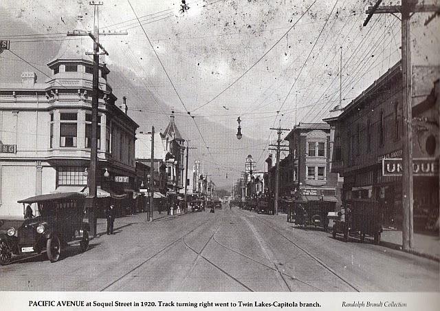
Also in 1884, the corner of Bridge Street and Pacific Avenue got an anchor building, built by the Farmers Union. The large 2-story wood structure featured a 45-degee-angle projecting square bay at the street corner 2nd story and a large meeting hall upstairs. In the photo at right from 1920, the Farmer’s Union is at far right.
Across Bridge Street in this photo can be seen the 1910 Trust Building, which survived until the 1989 earthquake - as did the 1894 Hihn building at far left, at the corner of Pacific and Lincoln. The Farmer’s Union corner was later occupied by the 1921 “Zig-Zag Moderne” (a variety of Art Deco style) Bank of Italy building, which was saved from the wrecking ball by local preservationists and is now a nicely-repurposed New Leaf grocery store.
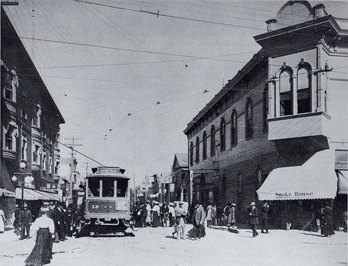
In the 1911 photo at left, looking east from Pacific Ave, the Farmers Union building is on the right, with the brand-new Trust Building on the left. Typical of the 2-story commercial buildings built from the beginnings of Santa Cruz County towns, the entire upper floor of the Farmers Union building was a large single multi-purpose room, usually referred to a a "hall". Such halls were common uses for upper floors of commercial buildings in those days.
Prior to construction of the Farmers Union building, the corner had been occupied by the residence of early downtown merchant J. B. Arcan. The upstairs room of the Arcan house was another meeting hall, the eponymous "Arcan's Hall". Bridge Street, before the covered bridge was built in 1874, was called Arcan Street. The Arcan house was moved toward the river to make way for the new corner building (thanks to Linda Rosewood for pointing me to this updated information. See also note 3).
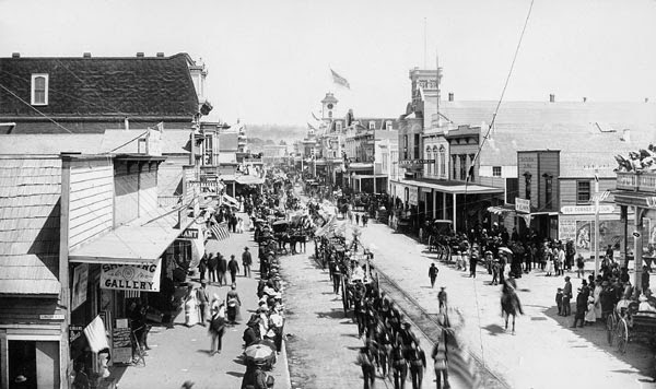
Beyond the Trust Building, in the 1920 photo, you can just make out the square medieval-style tower of the 1887 Masonic Hall. This 1899 photo (right) shows it more clearly, before the Trust Building and automobiles. In both photos, the "Town Clock" tower of the Oddfellows Building is visible farther up Pacific Avenue, as it looked before being rebuilt after an 1899 fire.
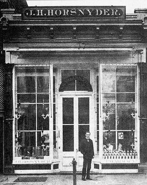
Across Pacific Avenue from the Masons, one of our oldest Santa Cruz businesses began in the block between Church and Walnut - Horsnyder’s Pharmacy, in 1884 (left).
New buildings between Walnut and Lincoln replaced the ramshackle structures of the first Chinatown, whose laundries and other businesses mostly moved to the now-aging north end of Front Street. The first 1880s commercial building in that block was a move, actually built in 1877 at the corner of Laurel by Jackson Sylvar, the Azorean native who had previously lived over his saloon on Mission Plaza (now Sylvar Street).
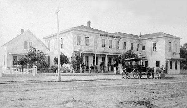
That same year, the Wilkins House hotel also opened south of Lincoln, but fared better than Sylvar’s “oyster saloon and lodging house”, expanding significantly in the 1880s (when the photo at right was taken). P. V. Wilkins had previously been proprietor of Santa Cruz House on Main (Front) Street.
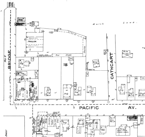
At the south corner of Lincoln, Duncan House (1878) was another development effort by Duncan McPherson, publisher of the Santa Cruz Sentinel. This detail from the 1886 Sanborn map shows and names the major buildings: the Fair Pavilion, Farmers Union, Duncan House and Wilkins House.
Toward the top of this map is east, with the San Lorenzo River edge indicated by "Marsh Land". At top left, Bridge Street ends at the covered bridge for which it was named.
Notes
- See Gary Griggs Wilder Ranch article re: "first electrical generating system"
- Rowland, Leon. Santa Cruz: The Early Years, p. 142, "The Fair Pavilion".
- Otto, George. Old Santa Cruz. Santa Cruz Sentinel, October 20, 1940.
- For more on the buildings, see Chase, The Sidewalk Companion to Santa Cruz Architecture (Downtown chapter).
