History Pages: 2 - The Explorers
For a table of contents, see History pages.
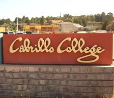
Unlike some other areas of coastal California, Santa Cruz was missed by the early European explorers. First to come close was the Spanish expedition led by Juan Rodríguez Cabrillo, who sailed north from Mexico in 1542 on a mission to explore the unknown coast. Cabrillo gave names to many places in California but, probably because most records the voyage were lost when the expedition ships were wrecked, none of those names were retained by future Spanish explorers. Cabrillo landed at places now known as San Diego, San Pedro and the [Santa Barbara] Channel Islands. He sailed past Point Conception [named later by Vizcaíno], missed the entrances to Monterey and San Francisco bays, and made it as far north as the mouth of the Russian River before turning back. On the way south, he found and sailed into Monterey Bay but [apparently] didn’t land. Still, Cabrillo was the first European to come anywhere close to Santa Cruz, so his is the oldest European name to appear on local signs - at Cabrillo (community) College.
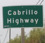
In 2021, the local reputations of early Spanish explorers have declined. There's a movement afoot to rename Cabrillo College, and a committee is studying the issue. The other prominent local display of Cabrillo's name is on the section of Highway 1 that runs the length of Santa Cruz County from north to south. The photo is of a sign from San Mateo County, but there must be one or more of those signs locally.
Another controversy about Cabrillo specifically (and locally) has been the claim that he was Portuguese rather than Spanish, so his name should be spelled Cabrilho. Wikipedia has had several edit wars, with rival editor groups moving the article back and forth between the two spellings. The current compromise version lists both spellings, but with Spanish first.
On the basis of Cabrillo’s voyage, Spain claimed the California coast as part of New Spain, a huge area that included today’s Mexico and Central America in addition to much of the south-western and south-central United States. England also had colonial ambitions, and Queen Elizabeth dispatched Francis Drake in 1577 to plant the British flag. During his round-the-world journey, Drake sailed south along the northern California coast. The exact location of his landings is unknown, but no one has ever claimed he came as far south as Santa Cruz.
After Cabrillo, other Spanish maritime explorers established a Mexico-Manila trade route by following the prevailing winds each way across the Pacific. The northern return winds brought the galleons to the northern California coast, then south along (but usually not too close to) the coast. It's quite possible that one or more of the galleons sent parties ashore near Santa Cruz to get water and firewood, but there's no evidence.
Deciding that one or more established harbors were needed to assist the galleons, Spain sent another sailing expedition north from Acapulco, led by Sebastián Vizcaíno, which arrived at the southern end of our bay in 1602. Vizcaíno named it Bahia de Monterrey, after the Viceroy of New Spain at that time. The name stuck, superceding Cabrillo’s Bahia de los Piños (Bay of Pines). Vizcaíno named lots of other places around Monterey and further south, but never came to our end of the bay. His expedition left without establishing a settlement, and our quiet bay was left to the Ohlone once again.
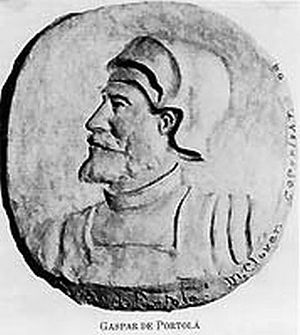
Over 150 years later, Spain was finally roused to action by the expansion of British and Russian trading posts southward along the Pacific Coast from Alaska and Canada. In 1769, a land expedition commanded by Gaspar de Portolà set out from Loreto, on the Baja California peninsula, to rediscover the bay described by Vizcaíno. They reached the bay on a typical summer day and found the bay obscured by fog. They didn’t even realize they were on the shores of a bay. Thinking they had not yet reached Monterey Bay, Portolà’s party turned north along the shore.
Reaching the river that now forms the southern boundary of Santa Cruz County, the soldiers of the Portolà expedition found a large bird that had been stuffed by natives and left at an abandoned village near the river. They dubbed the river Rio de Pajaro (Spanish for bird), and their anecdotal name outlasted the religious-themed name recorded by the expedition priests. Farther on, at Pinto Lake (on the west side of Watsonville), there's a mounted bronze plaque commemorating the expedition's first sighting of the Coast redwood tree, given the descriptive name "palo colorado" on October 10, 1769.
Several more days of marching brought the expedition to a large river which they named Rio de San Lorenzo. Crossing the river, they found a spring-fed creek which they named Arroyo de Santissima Cruz. The creek, which flows into what's now called Neary Lagoon, is known today on city watershed maps as Laurel Creek. Soon, Portolà moved on up the coast to discover the San Francisco Bay before turning around and marching back to San Diego. He never returned to Santa Cruz, but those three names stayed on. More than 20 more years were to pass before the next arrival of European visitors. These Spaniards, however, came to stay.


