Difference between revisions of "Aptos Creek"
From Santa Cruz County history wiki
| Line 1: | Line 1: | ||
| − | '''Aptos Creek''' drains a major mid-county watershed before emptying into Monterey Bay. Its major tributaries, Valencia Creek and Trout Gulch Creek, merge with Aptos Creek in the eastern older part of [[Aptos]]. Upstream from Aptos, a large part of the watershed comprises [[The Forest of Nisene Marks State Park]]. | + | [[File:Aptos-Creek-mouth-bridge.jpg|right]] |
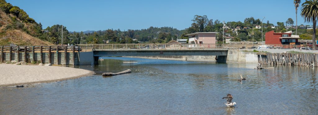
| + | '''Aptos Creek''' drains a major mid-county watershed before emptying into Monterey Bay. Its major tributaries, Valencia Creek and Trout Gulch Creek, merge with Aptos Creek in the eastern older part of [[Aptos]]. Upstream from Aptos, a large part of the watershed comprises [[The Forest of Nisene Marks State Park]]. The photo shows the creek mouth at [[Seacliff State Beach]], crossed by a pedestrian bridge. | ||
[[Category:Water]] | [[Category:Water]] | ||
Latest revision as of 20:56, 17 December 2023
Aptos Creek drains a major mid-county watershed before emptying into Monterey Bay. Its major tributaries, Valencia Creek and Trout Gulch Creek, merge with Aptos Creek in the eastern older part of Aptos. Upstream from Aptos, a large part of the watershed comprises The Forest of Nisene Marks State Park. The photo shows the creek mouth at Seacliff State Beach, crossed by a pedestrian bridge.
